

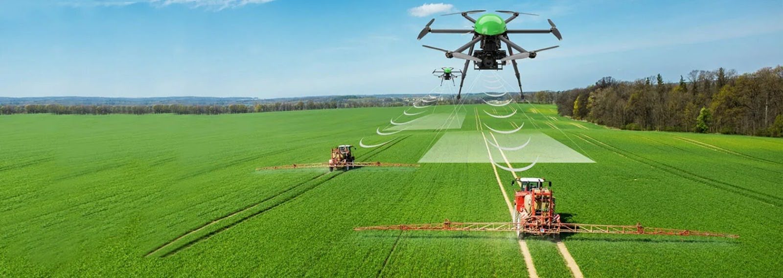
The integration of technology into farming practices has transformed traditional agriculture, making it more efficient and sustainable. One of the most significant advancements in this domain is the use of agriculture drones. These flying devices are revolutionizing how farmers map their fields and plan for effective land use and crop rotation. By utilizing drones, farmers can gather high-resolution imagery and data analytics that lead to informed decision-making.
This not only enhances productivity but also promotes better resource management. It is important to understand how agriculture drones can facilitate effective field mapping and planning is essential for optimizing crop rotation and ensuring sustainable practices.
Why Is Field Mapping Important for Farmers?
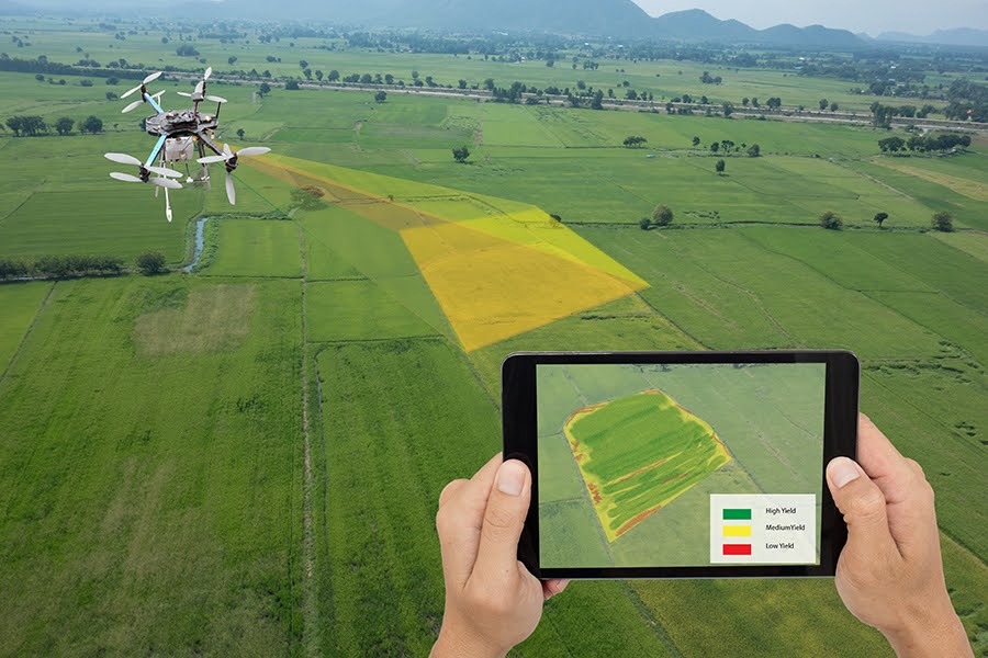
Field mapping is a necessary component of modern agriculture. It involves creating detailed maps that illustrate various aspects of farmland, including topography, soil type, moisture levels, and existing crops. This information is essential for farmers to make informed decisions about planting, irrigation, fertilization, and pest management. Effective field mapping allows farmers to identify specific areas that require attention and optimize resource allocation, leading to improved yields and reduced costs.
Here are the benefits of accurate field mapping:
- Enhanced Visualization
- Improved Crop Planning
- Recognition of Patterns
- Precision Agriculture
- Informed Resource Allocation
- Increased Yields
- Risk Mitigation
This empowers farmers to adapt their strategies based on historical data, environmental conditions, and soil types, ultimately leading to improved farming efficiency and sustainability.
How Agriculture Drones Enhance Field Mapping?
Agriculture drones have transformed field mapping, providing farmers with accurate, efficient, and cost-effective solutions. These unmanned aerial vehicles (UAVs) equipped with advanced sensors and cameras enable detailed mapping, analysis, and decision-making. Here’s how agriculture drones enhance field mapping.
1. High-Resolution Imaging
Agriculture drones, such as Talos Drones, capture high-resolution images of farmland using specialized cameras that deliver exceptional clarity and detail. This technology enables farmers to visualize various aspects of their fields, including crop health, soil quality, and irrigation needs. With high-resolution imaging, farmers can accurately assess the condition of their land and identify areas that require attention. This precise mapping capability ensures that farmers make informed decisions, ultimately enhancing productivity and efficiency in their operations.
2. Multispectral and Thermal Imaging
Drones equipped with multispectral and thermal sensors capture data beyond visible light. Multispectral imaging assesses crop health by measuring reflectance across various wavelengths, while thermal imaging detects temperature variations in the field. These imaging techniques help farmers understand irrigation issues and monitor crop stress effectively.
3. Efficient Data Collection
Traditional field mapping methods can be labor-intensive and time-consuming. Agriculture drones significantly enhance efficiency by covering large areas quickly, allowing for rapid data collection. Frequent flyovers provide farmers with up-to-date information, enabling them to adapt management practices and reduce labor costs in the process.
4. Accurate Field Mapping and Analysis
Drones with GPS technology create georeferenced maps that detail elevation, contours, and field boundaries. This accurate mapping enables farmers to analyze land effectively, identifying variations such as soil types and moisture levels. By utilizing mapping software, farmers can make informed decisions on crop rotation and resource allocation.
How do drones aid in agricultural land use planning?
By utilizing advanced imaging technology, farmers can gather necessary information about their land, facilitating better management and optimization of resources. Here’s how drones aid in this process.
1. Optimizing Crop Rotation Strategies
Crop rotation is essential for maintaining soil health and optimizing yields, but determining the best rotation schedule can be complex. Agriculture drones provide essential insights into crop performance across various field areas. By analyzing drone imagery, farmers can see which crops thrive or struggle, enabling them to adjust their rotation plans for healthier, more productive farming.
2. Assessing Soil Health and Fertility
Soil health is vital for successful farming, and drones can significantly enhance soil assessments. They gather data on moisture levels, organic matter, and nutrient availability, helping farmers identify areas needing attention. This insight allows for targeted interventions, promoting sustainable practices while minimizing reliance on synthetic inputs and maximizing crop productivity.
Enhancing Planning Processes with Drones
Before planting, farmers conduct field assessments, and agriculture drones simplify this by providing aerial views and detailed data on field conditions. This information helps identify potential challenges, such as pest infestations or flooding risks, allowing farmers to proactively address issues and adjust planting strategies, ultimately enhancing efficiency.
Post-harvest analysis is important for improving land use and crop rotation. Drones provide insights into crop performance and field health after harvest. By analyzing imagery, farmers can evaluate which crops thrived or struggled, informing future planting decisions and refining their crop rotation strategies for continuous improvement.
FAQs
How do agriculture drones improve crop monitoring?
Agriculture drones enhance crop monitoring by providing high-resolution imagery and real-time data analysis.
What features should I look for in an agriculture drone for field mapping?
When selecting an agriculture drone for field mapping, look for high-resolution cameras, multispectral sensors, and long flight times.
Conclusion
Agriculture drones have become invaluable tools for farmers looking to enhance field mapping and planning for efficient land use and crop rotation. By utilizing the high-resolution imagery and data analysis capabilities offered by drones, farmers can make informed decisions that lead to improved yields and resource management. Adopting agriculture drones is a forward-thinking approach that not only maximizes productivity but also fosters sustainable practices in modern farming.